Clasificación de la salinidad del suelo mediante imágenes de satélite y las redes neuronales artificiales
DOI:
https://doi.org/10.33017/RevECIPeru2013.0001/Keywords:
Neural Network, NDVI, TM, ETMAbstract
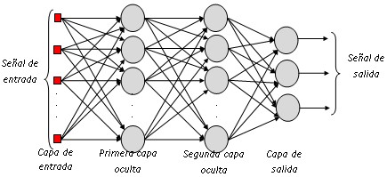
The change climate processes have called attention of science in recent decades; situations such as desertification and drought are issues of great importance. Where it was the interest to study the soil salinity and the Normalized Difference Vegetation Index (NDVI) from images of the ETM + and TM sensors, these images were processed using the software ENVI 4.5 and IDL programming language. For this purpose, we implemented an artificial neural network with error back propagation architecture, for classifying soil salinity, using as input data of images NDVI and data soil electrical conductivity for the training. The areas studies were the commission irrigation Muy Finca and the districts of Morrope and Lambayeque belonging to the region Lambayeque-Peru. For the neural network architecture using 2 hidden layers presenting a training error of 0.27, these results were evaluated using the confusion matrix, Kappa index and overall accuracy rate, obtaining a kappa index of 0.92 and over all accuracy rate was 94.74%. Finally we obtained a classified image of the spatial distribution of salinity in soils, classification has resulted 3196.26 as strongly saline soils, 2818.53 you as strongly saline soils, 3918.96 you as moderately saline soils, 10296.63 you as slightly saline soils and 2349.36 have as non-saline soils.


