Determinación del Relieve 3D de la Superficie de Marte usando un UAV
DOI:
https://doi.org/10.33017/RevECIPeru2015.0005/Keywords:
Drone, UAV, Mars, 3D relief, image processing, photogrammetryAbstract
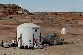
In this article its presented the development of an UAV (Quadcopter) about 3D relief obtainment of Mars surface, the purpose of the research it to provide a modern and reliable tool to crewmembers on future space explorations, which will have the opportunity of send this machine to perform recognizing and mapping mission of an specific area. The main objective about the development of this device is to ensure the phisic integrity of people in any research mission or exploration mission of unknown places. It could be driven remotely and receive precise relevant information previously to the human exploration, which give a better vision of the researched area. This project was developed in the simulation program at MDRS (Mars Desert Research Station) organized by The Mars Society, the station is located in Utah desert in the USA. In that place was performed the simulation of mars survival. The development of the entire project consisted into two main stages, the first part was focused on hardware and software analysis of the Quadcopter. It was selected the main components, main frame and control parameters for a stable flight. The second part was oriented to the creation of an image processing algorithm and 3D relief obtaining, which was built on Matlab. On the Research Station the simulations, flight proofs and data collection were performed. The Quadcopter could be operated using a remote controller for mapping many zones, also it is provided of a GPS unit, which allow to set points in the air and follow a given range recording a defined region. The principle used in image processing is called photogrammetry, which use digital photos. Then, patterns and reference points are recognized to define the photographed surface into a 3D model. A GoPro camera was used to get pictures because this kind of devices are very resistant to dust and humidity also it gives high quality photos, important for the subsequent analysis. Close places to the station in the Utah desert were experimentation places. It helped to calibrate control flight parameters of quadcopter and image processing parameters on Matlab. Reached results during first tests were optimum, which demonstrate that methods used are correct, but precise results haven’t reached yet, because there is an average error percentage. Currently it’s been working on the improvement of the Quadcopter hardware and in the image processing program to get better results. This work is a contribution to the scientific literature in the space exploration field. This specific topic was not well developed, so it’s hoped that it serve as base for many new projects and the development of innovative devices related to this.


