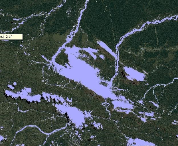
Enmascaramiento de nubes en la Regiones de "Madre de Dios", "Cuzco" y "Puno" (Perú) mediante el paquete landsat del lenguaje de programación R y la comparación con el enmascaramiento de CLASLlite 3.1
DOI:
https://doi.org/10.33017/RevECIPeru2013.0016/Keywords:
CLASlite, Library rgdal, Deforestation, optical imagesAbstract
Clouds and cloud shadows are common features in the visible and infrared images, which are detected in many distant parts of the world, particularly in humid and tropical regions such as the field of study of this article. Many ask us, what is the main reason for the cloud masking. Well, the main reason is to eliminate masking covers that will not be part of the analysis of deforestation which is necessary to remove such that the final interpretation faster and easier to perform. For this we must use some R libraries as rgdal, sp, mgcv and landsat to mask quite satisfactorily all the clouds, cloud shadows, water bodies and topographic shading. Filter the pixels of clouds in the optical images, entails a difficult task if you do not have automatic algorithms that are available in programs like CLASlite or otherwise. Therefore, this study shows a fairly simple and semiautomatic methodology that involves a large percentage programming in R -project, managing QGIS (Free Software and Open Source) and the use of the bands 1, 2, 5 and 6 satellite Landsat TM.
As part of the methodology will turn all of the bands used in reflectance values, i.e., a calibration will use the metadata of the scene itself. Note that to pass the thermal range with digital temperature levels to values (degrees Kelvin) will make use of landsat package R -project, allowing us to achieve calibration.
Completed this conversion to reflectance values for all bands except the thermal band using Landsat librereria again, we will create a cloud mask with band 1 and 6. This step will select those pixels having a characteristic threshold clouds. The difficulty is that for a threshold of 0.00042 not only select pixels which are clouds, but other pixels that are not. To minimize this error, use some indices such as NDVI, NDSI, allowing us to finally masking clouds, cloud shadows, water bodies and much of topographic shading.
As a final point of this study. A comparison of masking obtained with masking will CLASlite 3.1. CLASlite is a software package created by the team of the Department of Global Ecology at the Carnegie Institution for Science. It is designed for highly automated identification of deforestation and forest degradation using remote sensing images.


