Identificación de patrones relevantes a la sequía agrícola a partir del análisis espacial y temporal del Índice de Condición de la Vegetación – Caso estudio: Áreas agrícolas de la región Piura, Perú (2000 - 2017)
DOI:
https://doi.org/10.33017/RevECIPeru2018.0013/Keywords:
Drought, spatial patterns, agricultural areas, dry land, irrigated land, ICVAbstract
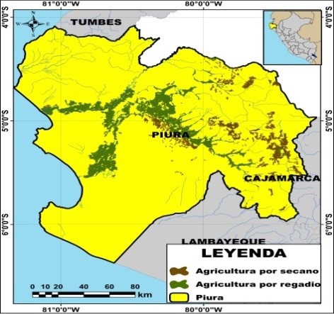
The present work, the spatial and temporal evolution of the Vegetation Condition Index (VCI) is analyzed, with the purpose of identifying patterns relevant to the occurrence of agricultural drought events in Piura. The VCI provides information about the growth state of the vegetation during extreme situations, and it is derived from the product: Normalized Difference Vegetation Index (NDVI) values - MODIS (Moderate-Resolution Imaging Spectroradiometer) sensor data at a spatial resolution of 1 km in the period 2000-2017 on board the Terra satellite (MOD13A3, version 6) Obtained in its passage between 10:30 am and 12:00 pm (local time). The spatial patterns of the VCI reveal that, in the case of rainfed agricultural areas, in 2004, 21 % presented extreme and severe drought conditions, while in 2007 it was 19.5 %, in 2011 the 15.5 % and 2014 reached 21 %. On the other hand, in the case of irrigated agricultural areas, 44.2 % were affected in 2004, 55.4 % in 2005, 38.8 % in 2007, 17.1 % in 2011 and 37.1 % in 2014.


